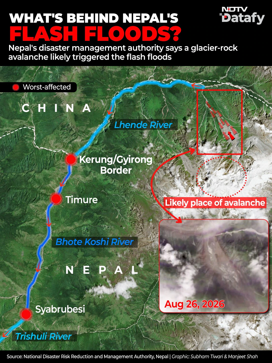
When a towering wall of sludge swept through settlements along the Bhote Koshi river on August 26, communities had little warning of what was coming.
Satellite Monitoring: A New Tool for Early Warning in the Himalayas
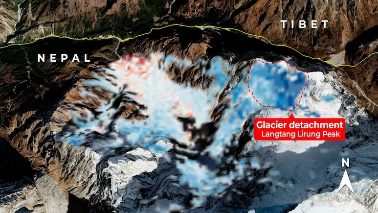
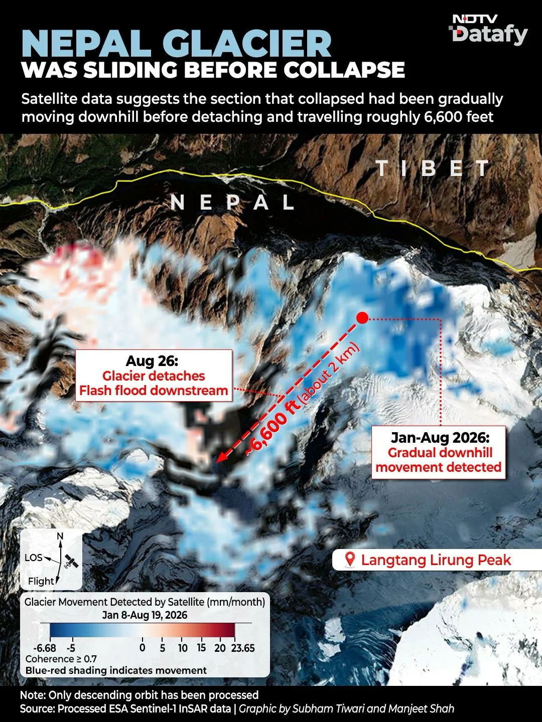
Recent analysis of Sentinel-1 Synthetic Aperture Radar (SAR) data has revealed that an ice and rock formation in the Himalayas was moving downhill prior to its collapse. This finding underscores the potential for satellite-based radar monitoring to enhance early-warning systems in the region, which faces ongoing threats from similar geological events.
The analysis, conducted by NDTV Datafy, utilizes pixel tracking to observe shifts in the position of ice and rock. In this system, blue pixels signal potential downslope movement, while red pixels show areas where ice or mud is accumulating.
As scientists and geospatial experts explore these technologies, the hope is that such monitoring can provide timely alerts and help mitigate the risks associated with natural disasters in the Himalayan region.
How Radar Satellites Track Glacier Movement
For our analysis, we used Line-of-Sight (LOS) velocity, which measures movement towards or away from the satellite along its viewing direction. There is, however, an important limitation. A satellite does not measure the full three-dimensional movement of a glacier in a single LOS measurement.
Movement that occurs perpendicular to the satellite’s viewing direction may therefore be underestimated or missed.
What Other Satellite Analyses Found
A researcher at China’s Chang’an University, analysing data from NISAR, the NASA-ISRO Synthetic Aperture Radar satellite mission, said the cumulative motion in the glacier’s break-off area was on a “meter-scale”. Dr Nithiyanandam Y, head of the Geospatial Research Program at Bengaluru-based Takshashila Institution, said geospatial intelligence could strengthen early-warning mechanisms for flash floods of the kind seen in Nepal. “A combination of optical satellite imagery, radar data, InSAR and LiDAR, river flow measurements, seismic records, and high-altitude weather observations can all assist in tracking slope movement, glacier and lake changes, debris movement, and downstream exposure,” he wrote in a newspaper editorial.