
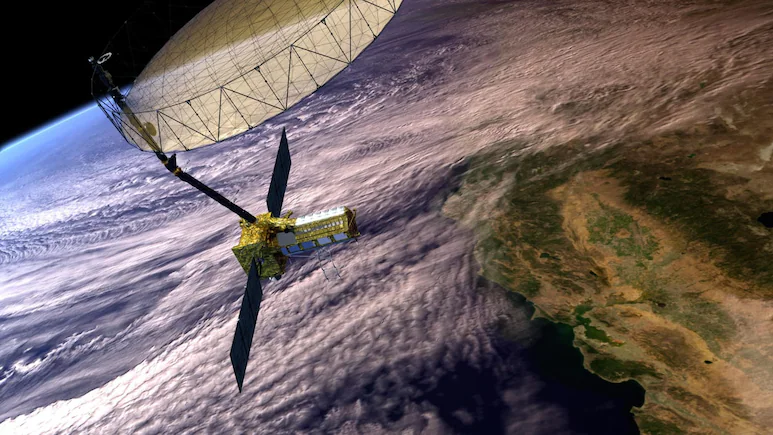
But nobody was watching, and hence no warning was issued. The world’s single most expensive civilian Indo-US Earth imaging satellite, NISAR, costing $1.3 billion, saw the warning signs in the Nepal Himalayas.


Additional fatalities were also reported in the Tibet Autonomous Region of China. The evidence was embedded in the voluminous data, but neither ISRO nor NASA connected the dots. Here is a plaintive chronicling of the lessons from NISAR’s unheard alert. But the signals were only discovered after the disaster, underscoring a hard truth of modern Earth observation: detecting danger is one thing; continuously monitoring and interpreting enormous volumes of satellite data in real time and issuing a timely warning is quite another. Users can analyze the data to generally assess the risk of future disasters. Scientists also found evidence that climate change may have contributed to the disaster. Such sustained warmth would have increased glacier melt, generated more meltwater and destabilised slopes already under stress.
The real mystery is why nobody was watching the data as it was beamed down every 12 days. The devastating Nepal Rasuwa flash flood of August 26 is emerging as a defining lesson for scientists, disaster managers and governments across the Himalayan region. The world’s single most expensive civilian Earth observation satellite, the $1.3 billion NASA-ISRO Synthetic Aperture Radar (NISAR) mission, had in fact detected subtle movements in the glacier and rock mass that ultimately collapsed as it was supposed to do. According to figures cited in the latest ISRO study from Nepal’s National Disaster Risk Reduction and Management Authority, the disaster had claimed 1,451 lives, while 5,745 people remained missing as of September 21, 2026. Using satellite data, they determined that the summer of 2026 was exceptionally warm. Air temperatures remained significantly above the long-term average from 2001 to 2025 and frequently approached or exceeded one standard deviation above normal conditions. Daily temperatures reached between 8 and 9 degrees Celsius, making 2026 one of the warmest years in the 26-year record for the region.
NASA’s Jet Propulsion Laboratory in California, in a statement to NDTV, said, “The data from NISAR, including what its instruments have collected in the area of the flooding, has been and continues to be freely accessible to the public via the Alaska Satellite Facility Distributed Active Archive Center and ISRO’s Bhoonidhi portal.
But no one took heed. The results showed accelerating deformation and creep in the escarpment section before failure. Some pixels recorded cumulative horizontal offsets exceeding five metres.
The findings come from the first scientific paper published on the Nepal disaster by 12 scientists from ISRO’s National Remote Sensing Centre (NRSC), Hyderabad. The NRSC study found that NISAR’s L-band radar data covering the period from June 20 to August 19, 2026 clearly identified an unstable high-velocity zone exactly where the catastrophic collapse later occurred. In the final monitoring interval between July 26 and August 19, displacement vectors became larger, more coherent, and spread across much of the eventual collapse zone.
The study reconstructs the entire chain of events that led to one of the deadliest Himalayan disasters in recent memory and reveals that NISAR had detected “precursory movement” in the mountains weeks before the catastrophic collapse.
For ISRO and disaster management agencies, the study offers a powerful roadmap for the future. The answer is not simply launching better satellites. NISAR has already demonstrated that it can see the warning signs. The next step is building systems capable of continuously monitoring the entire Himalayan region, automatically flagging unusual glacier movements, identifying accelerating creep, and integrating satellite observations with climate, geological, and seismic data.
