
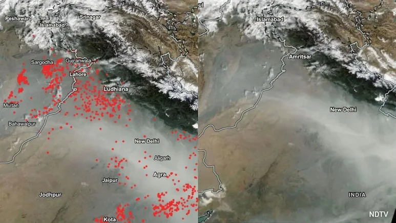
Today, Punjab and Haryana farmers use similar tactics to evade farm fire detection Dr APJ Abdul Kalam mastered satellite evasion for Pokhran’s atomic tests.
Farmers have now learned that satellites can only see what happens when they pass overhead. If fields are set ablaze outside those observation windows, many fires go undetected.
“To design effective interventions, we need to know not only how many fires are detected, but also where and when burning takes place and how much land is affected. Fire Watch brings these data together to make better information available to policymakers and the public. Unlike polar-orbiting satellites that make only periodic visits overhead, these geostationary satellites observe the same region repeatedly, generating imagery approximately every fifteen minutes. Consequently, environmental agencies may not automatically receive unrestricted access to its data products. Many scientists argue that this issue deserves careful reconsideration.
Because it would reduce opportunities for exploiting observation gaps, scientists believe such a platform could transform farm fire monitoring. In May 1998, under the leadership of scientists including Dr APJ Abdul Kalam, India conducted the Shakti series of five nuclear tests at Pokhran in Rajasthan while successfully concealing crucial preparations from some of the most sophisticated American spy satellites in orbit. The platform integrates data from MODIS and VIIRS for active fire detection, while adding observations from Meteosat-8 and Meteosat-9 carrying the SEVIRI instrument. A 2026 Parliamentary Standing Committee recently observed that, despite India’s achievements as a leading space power, the country continues to rely heavily on foreign satellite systems for monitoring forest fires and similar environmental events. EOS-05 is regarded as a strategic national asset, and its operational control structure involves defence and national security considerations. If satellite observations can aid pollution control, they argue, then at least part of such EOS 5 satellite data should be made available for civilian environmental applications.
