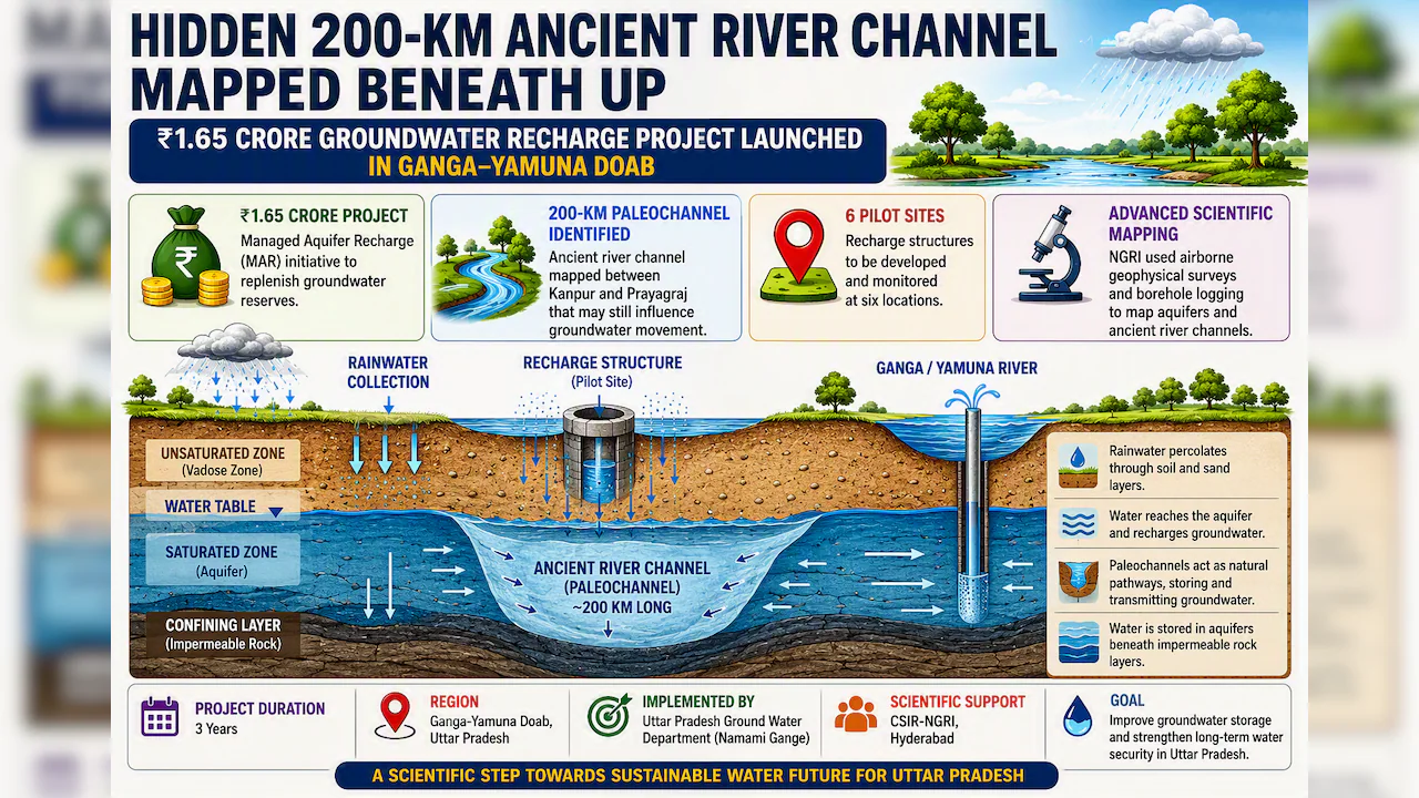
The Uttar Pradesh government has initiated a Managed Aquifer Recharge (MAR) project aimed at enhancing groundwater conservation. Valued at Rs 1.65 crore, this scheme will be implemented over three years in the Ganges-Yamuna Doab region. The project focuses on directing rainwater into underground aquifers, which is essential for replenishing depleted water reserves and ensuring long-term water security across the state.
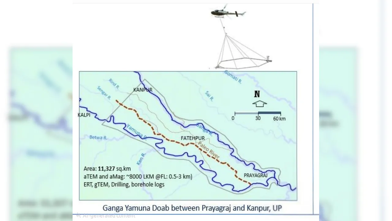
The Uttar Pradesh government has launched a three-year Managed Aquifer Recharge project in the Ganges-Yamuna Doab region following the discovery of a 200km ancient underground river system between Kanpur and Prayagraj.
Pilot Scheme Launched Across Six Locations Funded by the National Mission for Clean Ganga and implemented by the Uttar Pradesh Ground Water Department, the project will run for three years. Scientists believe these paleochannels still act as natural pathways for subterranean water flow. 200km Ancient River Course Mapped Dr Rajesh Kumar Prajapati, Special Secretary for the Namami Gange and Rural Water Supply Department and Director of the Ground Water Department, stated that researchers from the CSIR-National Geophysical Research Institute (NGRI) in Hyderabad identified the system using advanced technologies, including helicopter-borne geophysical surveys and borehole logging. These tests mapped deep aquifers and ancient river courses beneath the Ganges-Yamuna Doab, revealing subsurface tracks that can actively channel groundwater. Directing Rainwater to Aquifers The project aims to catch surface runoff during rains and send it directly into aquifers-the natural rock and sediment layers that supply wells and tubewells. Scientific mapping will pinpoint where rainwater can sink into the ground most easily, guiding the installation of recharge systems. Six pilot sites have been chosen for the initial phase, where recharge structures will be built and monitored to evaluate water absorption and table recovery. Scaling Up Based on Initial Results Scientists will monitor the six pilot sites to determine which recharge methods work best for different soil and aquifer conditions. Once proven successful, the framework will be expanded to other suitable locations across the Ganges-Yamuna Doab. Monitoring River-Groundwater Connections The NGRI study highlights strong hydrogeological links between the Ganges and Yamuna rivers and the deep aquifers beneath them. The ancient paleochannels play a vital role in moving water within these aquifers. The project will map the relationships between rainfall, river flow, groundwater, and these ancient channels to guide future conservation efforts. Strengthening Water Security Through Science Prabhash Kumar, Additional Project Director for Namami Gange, noted that technical support from NGRI will ensure rigorous scientific monitoring. Alongside structural work, the state will run public awareness campaigns using Information, Education, and Communication (IEC) activities to encourage local water conservation. (With inputs from Ajay Dubey)
Scientists identified a roughly 200-km-long ancient river channel (paleochannel) beneath the Ganga-Yamuna Doab between Kanpur and Prayagraj.